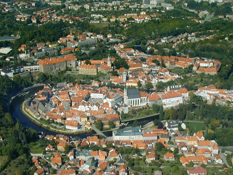
Český Krumlov Castle is unusually large for a town of
Krumlov's size; within the Czech Republic it is second in extent only to the
Hradčany castle complex of Prague. Inside its grounds are a large rococo
garden, an extensive bridge over a deep gap in the rock upon which the castle
is built, and the castle itself, which in turn consists of many defined parts
dating from different periods of time.
The first mention of the water run on the square in
Český Krumlov appeared in fire and police regulations for Český Krumlov
burghers compiled by Jan from Rosenberg in April 1388. At that time the water
tank was made of wood.
The stony fountain first appeared in the town in 16th
century.
In 1843, because of the rusty condition the fountain
was abolished, and a new one was built by the Plague Column in the upper part
of the square.
Latran is the name of both the town quarter and the
street passing through this quarter. At first it was the name of the area below
the castle of Český Krumlov, which Wilhelm of Rosenberg linked to the inner
town to form a whole in 1555. Latrán Street starts at Lazebnický (Barber)
Bridge and ends at Budějovická Gate. Apart from a number of important burgher
houses, the former St. Jodock’s Church is found here, and the street leads to
the castle complex and the Monastery of the Order of Knights of the Cross with
a Red Star.
The first improvised revolving stage first turned in
1958 so that sixty spectators could see the play Lantern by Jirásek. The
original revolving stage was driven by human power, but not many people knew
about it at that time. The first night was such a success that 22 performances
followed and as can be seen, it was the first step in establishing a tradition
of modern summer seasons in the Open-air Theater.
LIFESTYLE
The best way to get to know the fairytale beauty of
the historical centre of Český Krumlov is to walk around its picturesque narrow
lanes, take in the multicoloured facades of the town houses, wander into the
traditional little shops or visit one of the many cultural events.
Summer holidays start today and this means the end of
classes and of our activity for this academic year. We would like to express our special thanks
to the students and teachers who have taken part in this project; it’s been so exciting
to send postcards to so many different countries and read all the interesting
information you’ve shared about Ourense and the destination/origin of the
different cards!
We’ve received 58 cards and have sent 48 so far, which
makes a total of 106 travelling postcards! Postcrossing at Padre Feijoo-Zorelle has been a huge success and we look
forward to sending more cards in September, when we come back from summer
holidays.
Please, keep posting your comments on your favourite
entries, this last one includes the last four postcards with which we conclude
this school year: Stop 45: Sastamala, Finland
Postcard 38 is
flying to Mimoň in the Czech Republic, 1,950 km away!
Lucía, one of our 4th grade students, has written a beautiful postcard showing O Carballiño's fish farm, which we hope our Czech friend Marta will like.
Go to EXPLORING PLACES to know more about the Czech town to which Lucia's postcard is travelling. If you want to find out more about O Carballiño's fish farm, click HERE.
J. I. D. Putz had
it built as a copy of the Holy Sepulchre in Jerusalem at his own expense. It
features a three-wing ambit surrounded by walls, a small portal with the coat
of arms of the Putzs of Alderhuzm, cross vault and arcades ending in a
crescent. The chapel was rebuilt and consecrated in 1992.
The bridge over
the Ploučnice near its confluence with virgin stream is first mentioned in
1620. At that time still a wooden bridge provided shelter mimoňského estate
owner Jan Müller from Mulhouse when it November 21, 1620 for participation in
the revolt came to arrest imperial troops.Shortly thereafter, he was probably
rebuilt in stone form, and in 1664 expanded into three arcs, such as stone is
safely drawn urban plans from 1770, when the river flowed beneath the third
arch.
We have received a
beautiful card from Kostelec nad Vltavou,
a village and municipality in the Písek District of the South Bohemian Region
of the Czech Republic, 1,875 kilometres away!
The postcard Václav has sent us features a map with
the location of his village.
We have done some reseach on Václav's village and have discovered that it is located quite near Sumava National Park, one of largest forested areas in Central Europe. If you want to learn more about this natural wonder, visit our section EXPLORING PLACES.
Děkuju, Václav! Máme rádi své pohlednice (Thank you, we love your postcard!)
Kostelec nad
Vltavou is a village and municipality in the Písek District of the South
Bohemian Region of the Czech Republic. The municipality covers an area of 32.81
square kilometres.
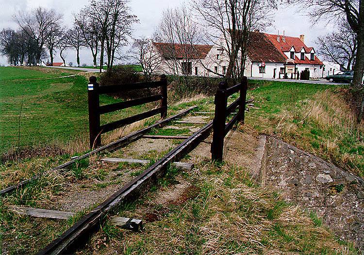
The oldest railway
line on the European continent, connecting České Budějovice and Linz, was built
in 1825-1832 mostly for the purposes of transporting salt from the Upper
Austrian Salt Chambers to Bohemia. It was the culmination of many years of
efforts to connect the watersheds of the Vltava and Danube Rivers.
The Šumava National Park and Protected Landscape Area
In 1963, Šumava
was declared a protected landscape area, and in 1991 the Czech government
declared it a national park. In 1990 it became a UNESCO biospheric reservation.
It holds remnants of glacier basins, glacier lakes, and stone and granite
outcroppings that resulted from glaciation. The national park is one of the
most extensive forestlands in central Europe and even though most of the forest
growth is secondary, it is approaching the condition of a natural forest
composition. Šumava is the headwater area for the longest Czech River, the
Vltava (Moldau).
LIFESTYLE
South Bohemia is a
dream paradise for holidays whether you decide to spend time sightseeing or
relaxing. The countryside here offers endless possibilities for visiting places
of natural beauty, but also has lots of historical monuments and great
conditions for cycling and water sports.
Strakonice is in the southwest of the Czech Republic. Strakonice can be found on the confluence of the gold-bearing Otava River and the Volyňka River. Today there live 23.000 inhabitants. It is situated about 60 kilometres from the town České Budějovice, 80 kilometres from the town Plzeň and 110 kilometres from the capital city Prague.
The Strakonice castle is an exceptional historical monument, both historically and architectonically. The oldest parts of the castle bear marks of the gothic architecture (The Saint Prokop’s church, the Rumpál tower), the Renaissance influenced the building of the Jelenka tower and the front side of the east part of the castle was rearranged in the classicist style.
The area of the castle has now been a place for various cultural actions. It is a residence of the Museum of Central Otava Basin with its exhibitions dedicated to Strakonice, pipers’ tradition or the production of fezes and motorbikes ČZ. In the western part of the castle there is a safari in a former moat where dwarf goats, sheep and ponies gambol.
The dominant of the Palacký Square is a baroque Marian column from 1730–1740. It was originally built on the Large Square ofter the great black death in 1586. Marian columns were erected to express thanks for diversion of a Black Death epidemics and as a pray to the Holy Virgin to save the town from the Black Death attack in the future. After the Second World War it was placed onto the Palacký Square.
The building of the former town hall replaced an earlier lower building with a torrent that was destroyed in a fire. It was a grammar school afterwards and now it is an elementary school. It is situated on the Large Square close to the town office. The academic painter Josef Bosáček decorated the forefront with colourful graffito in 1903 in accordance to thematic cards by Mikoláš Aleš.
The stone foundations of the eastern entrance to the town called Prague Gate were excavated and examined during the reconstruction of Velké náměstí ("Large Square"). It was built in the mid-16th century as a point of entry into the town. It was destroyed somewhere in the first third of the nineteenth century.
The stone foundations have been archaeologically researched and subsequently filled up.
A stone mosaic was installed on the spot in memory of the major local monument that once stood here.
LIFESTYLE
If you want to find out more about Strakonice and South Bohemia where it is located, watch the video below.




.svg/701px-Czech_Republic_in_Europe_(-rivers_-mini_map).svg.png)